The HerzegovinaBike Association constantly strives to improve the cycling experience on our routes throughout Herzegovina. We are proud to announce that the latest updates to the Ride with GPS, which now include Waypoints, are directly available to all our users. This new enhancement makes planning routes easier and more intuitive, while also improving navigation through the most beautiful parts of Herzegovina.
What are Waypoints?
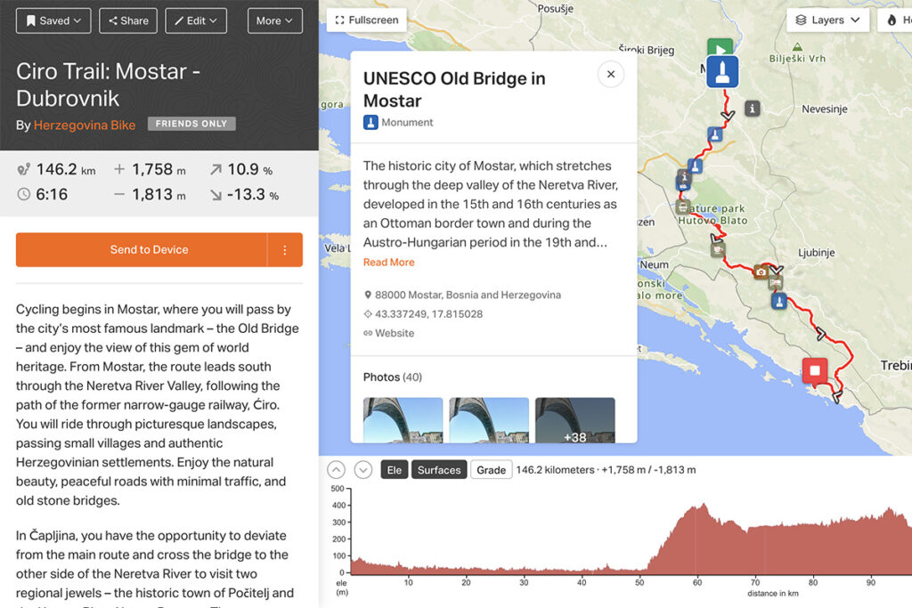
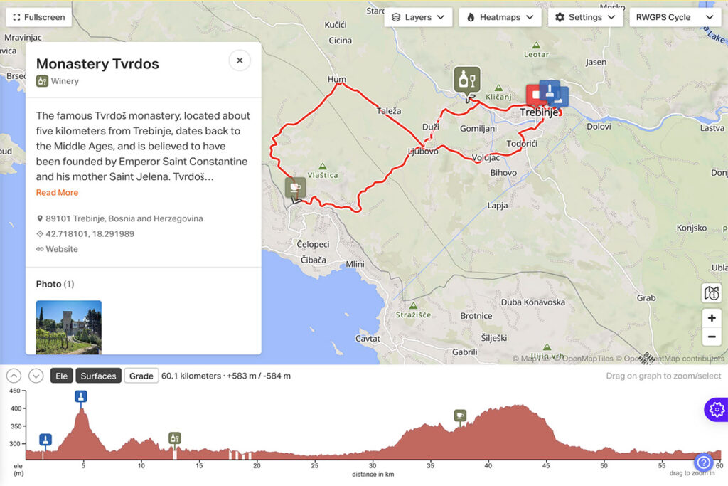
At the most basic level, Waypoints are points of interest along your routes. Unlike standard markers (POI – Points of Interest), Waypoints are directly connected to your route, making them much more functional. Why does this matter? Because now you can easily add, customize, and view key spots like landmarks, rest areas, viewpoints, or places to enjoy nature directly in the app or on your GPS device.
How does this enhancement affect routes in Herzegovina?
HerzegovinaBike maps and shares many cycling routes throughout Herzegovina, and new Waypoints in the Ride with GPS app now allow for:
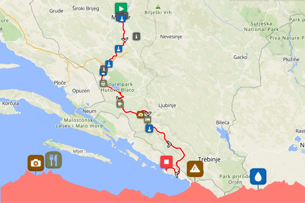
- More serious planning and navigation: You can now add exact locations you want to visit during your cycling trip. Whether it’s hidden viewpoints at the top of Mount Velež, rest areas along the Ćiro Trails, or historic sites, these points will be clearly visible on your device.
- More detailed information at every step: Each waypoint can include useful information such as URLs, photos, descriptions, and even estimated time of arrival. This way, not only do you know where you are, but you also have access to all the important info about the location.
- Improved real-time navigation: With the ability to export these points to your GPS devices (Garmin, Wahoo, Hammerhead, Coros) and mobile app, Waypoints let you know in advance how far you are from your next destination. Whether you’re riding toward the famous city of Mostar or exploring hidden trails along the Neretva, you’ll always have clear guidance.
Where will you see the Waypoints?
This update is now active in several key areas:
- Elevation Profile: You can now view waypoints directly in the elevation profile, which is especially useful when planning more challenging routes in the Herzegovinian mountains, like the climb to Blidinje or the mountain passes on Prenj trails.
- Cuesheet: Waypoints will appear in the new, improved cuesheet view, helping you track all key stops and the distances between them.
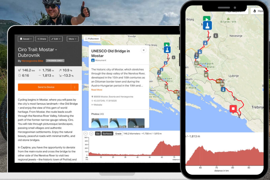
- Mobile app and GPS devices: Whether you're using the mobile app or your GPS device, Waypoints will help you remember every important stop during the ride – including pit stops, scenic views, water sources, and other key spots.
- Through embedded maps on websites: For cycling event organizers – including us – this is a great opportunity to share interactive route maps with detailed information on all points of interest via our websites.
How to add Waypoints to your route?
Whether you're planning your next Herzegovina ride on the web or in the mobile app, adding Waypoints is simple:
- Add marked points of interest directly into your planned route – like landmarks, cafés, or viewpoints.
- Use the search tool to find specific locations near your route.
- Customize your Waypoints by adding useful info such as URLs, photos, or other details.
Ideal for Cyclists in Herzegovina
This new functionality allows all cyclists using the Ride with GPS Ride with GPS app to navigate and plan their adventures across Herzegovina more easily. From magical trails in Blidinje to cultural landmarks in Mostar and Stolac, Waypoints will ensure you never miss anything important.
Thanks to this improvement, cycling through our region will now be even simpler and more informative. Get ready for better planning, smoother navigation, and of course – unforgettable adventures across Herzegovina!
For more information about our cycling routes, visit the HerzegovinaBike web page (link).