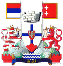
Bileća is a municipality and a populated place in southeastern Bosnia and Herzegovina. The area of the municipality is 632.33 km2. It is administratively part of Republika Srpska. According to the 2013 population census, the municipality of Bileća has 11,536 inhabitants. The municipality of Bileća is a border municipality with Montenegro, in the north with Nevesinje and Gacko, in the west with Berkovići and Ljubinje and in the south with Trebinje.
Geography
Bileća is located in eastern Herzegovina. The altitude of the city area is 476 m. In the area of Bileća, the Mediterranean and continental-mountain climates meet. The relief is hilly, between which there are karst fields: Dabarsko, Fatničko, Plansko and Bilećko. South of Bileća is the source of the river Trebišnjica. In 1966, a hydroelectric power plant was built and one of the largest artificial reservoirs in the world was created, Lake Bilećko, which is 18 km long and 3–4 km wide. With the construction of the Grančarevo dam on the Trebišnjica river almost half a century ago, its tamed waters, poured into the Bilećko lake, covered the villages of Panik, Orah, Čepelica, Zadublje and Miruše. In addition to houses and estates, a rich cultural and historical heritage from the Roman era remained under Lake Bileć.
History
Illyrian and Roman times
The first traces of civilization in the area of Bileća municipality date back to the Neolithic, as evidenced by archaeological sites that are still insufficiently explored. Prehistoric tumuli, mounds and mounds, of which there are over 2,000 according to the latest research, clearly indicate the continuity and density of the population. Of special note is the tumulus from Plana, in which two helmets, twelve spears, a large number of fibulae and hairpins (also known from Glasinac) were found.
The southern parts of the municipality of Bileća entered the Roman state in 135 BC. after the subjugation of Ardijejaci and Plerej (they held the area between Popova polje and Boka Kotorska). Together with Trebinje, it was part of Epidaurus (Cavtat), the southernmost Roman colony on the eastern coast of the Adriatic, as its hinterland. From that time is the famous U-villa urbanu in Panik, the property of a rich Italian, around which a large building complex developed, the center of a vast latifundia (arable fields, pastures, forests). Other buildings also belonged to this villa, villa rustica on the Dracova side, on Potkućnice and next to Trebišnjica, and a number of other buildings, including cult ones (temple, mausoleum, tomb). On the mosaics and frescoes of the U-villa from the 3rd century, symbols of Christianity (Orpheus, Medusa) are present, so researchers consider these to be the first traces of Christianity in the interior of Bosnia and Herzegovina. The local Epichorian population continued to live in their wooden and dry-walled settlements in the karst fields and fields, slowly accepting Romanization.
To the east of the Daorsa tribe, which was located in the area of Stolac, was the Deremisti tribe, in the area of Dabarski, Fatnica and Planski polje, and probably also on the site of the present-day town of Bileć. An inscription typical of the southeastern Illyrian region was found in Fatnica. Relatively rich archeological and settlement elements from the Dabar area, Fatnica, Orahovica and Plana speak of significant population in Roman times as well. This is best confirmed by the urban settlement in Orahovice with construction remains (foundation walls, profiled fragments of the roof cornice of a monumental building, lots of bricks and tiles), which are located on an area of 700x400 meters.
Middle Ages
The first mention of Bileća as a populated place can be found in the documents of the Dubrovnik archive from 1286, when it is mentioned under the name Bilechia. Bileća is also mentioned in the same sources and under the same name in the 14th and 15th centuries as an important crossroads on the medieval caravan route. In a document dated September 8, 1388, it is pointed out that the army of Duke Vlatko Vuković severely defeated the Ottoman army under the command of Šahin Pasha in the field near Bileća, which is also considered one of the first defeats of the Ottomans in the Balkans.
In the period from the 13th to the 16th centuries, history also records a large number of stećaks in these areas, which as monoliths weigh up to 5 tons. As part of the project that aims to nominate stećaks - tombstones for inclusion in the World Heritage List - UNESCO, the necropolis in the settlement of Baljci is from the territory of Bileć. Bileća fell under the Ottoman rule in 1466 and during the centuries of the Empire's rule in this area it suffered heavily due to eternal rebellions and resistance. In the immediate vicinity of Bileća is Vučji Do, where the famous Battle of Vučidol took place in 1876, in which 16 companies from Bileća took part. By the decision of the Berlin Congress, Bileća became part of the Austro-Hungarian Monarchy, and economic development took place during that period. The first elementary school in Bileća was opened in 1880.


